
LiDAR HAZARD MAPPING PROGRAM UKRAINE
SUPPORT THE UKRAINE HAZARD MAPPING PROGRAM
Your support enables informed decision-making where safety and complexity intersect.
The First Program Under the Fire & Forest Defense Initiative Ukraine (FFDI-UKR)
The LiDAR Hazard Mapping Program is the first funded program launched under the Fire & Forest Defense Initiative Ukraine (FFDI-UKR). It establishes the foundational data and planning capacity required for safe wildfire response and land management in environments affected by unexploded ordnance (UXO), landmines, and conflict-related contamination.
This program is implemented in partnership with Forest Release and National University of Life and Environmental Sciences of Ukraine, combining local expertise, academic rigor, and operational relevance.
PROGRAM CONTEXT
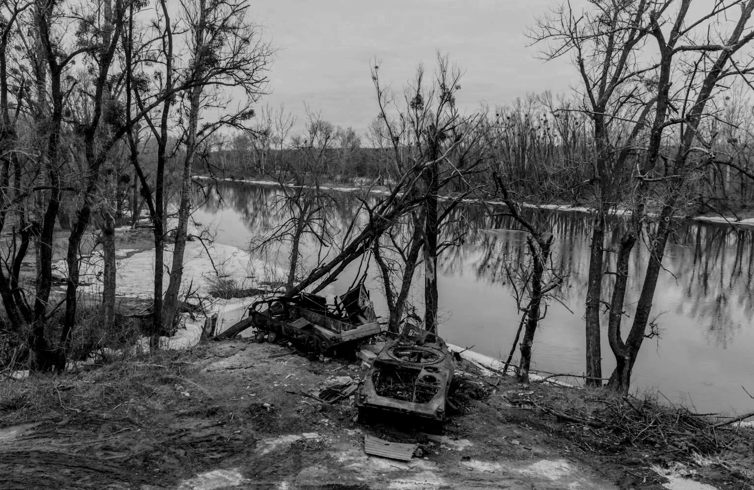
In Ukraine, large areas of forest and wildland are unsafe for traditional ground assessment due to UXO, landmines, and surface disturbance from military activity. These conditions significantly constrain wildfire response, fuel management, and recovery planning.
Before responders, land managers, or recovery teams can operate safely, they require accurate, remote, and actionable information about terrain, vegetation, and disturbance patterns.
The LiDAR Hazard Mapping Program addresses this need by delivering high-resolution terrain and hazard data without placing personnel at risk.
WHY LiDAR IS FOUNDATIONAL TO FFDI-UKRAINE
As the first program under FFDI-UKR, LiDAR hazard mapping establishes a shared operational baseline for all subsequent activities, including:
UXO-aware wildfire response planning
Training exchanges and field operations
Equipment deployment and mobility planning
Long-term land management and recovery
LiDAR enables informed decision-making before personnel are deployed, reducing unnecessary exposure and improving operational safety.
OPERATIONAL IMPACT
LiDAR data generated through this program supports:
Wildfire response planning in high-risk terrain
Identification of safer access routes, staging areas, and control options
Fuel and vegetation analysis for mitigation and preparedness
Post-fire assessment and recovery planning
All outputs are designed for practical operational use, not academic study alone..
PROGRAM COMPONENTS
-
Data Collection & Sensing
LiDAR data acquisition using appropriate aerial or mobile platforms, selected based on safety, coverage requirements, and operational constraints.
-
Data Processing & Analysis
Conversion of raw LiDAR data into:
High-resolution terrain models
Vegetation and fuel structure layers
Indicators of surface disturbance relevant to UXO risk
-
Operational Integration
Integration of LiDAR outputs into:
Wildfire planning workflows
Training and tabletop exercises
Operational decision-making by partner organizations
-
Capacity Building & Knowledge Transfer
Training and collaboration to ensure Ukrainian partners can interpret and apply LiDAR-derived information effectively and responsibly.
Partnership Framework
This program is delivered through collaboration with:
Forest Release
A Ukrainian environmental organization with deep local knowledge and field presence.National University of Life and Environmental Sciences of Ukraine
A leading academic institution providing technical expertise, data analysis, and applied research capacity.
FireFront Foundation coordinates program execution, funding, and alignment with the broader FFDI-Ukraine framework.
Relationship to UXO, Landmines, and Contamination
The LiDAR Hazard Mapping Program supports:
Risk-informed planning prior to field operations
Safer coordination with demining and recovery efforts
Reduced human exposure during assessment and planning phases
The program is civilian, preventative, and complementary to humanitarian and environmental recovery initiatives.
Funding supports:
LiDAR data acquisition
Data processing and analysis
Operational integration and training
Program coordination and reporting
This investment establishes a scalable foundation under FFDI UKRAINE programs
FireFront Foundation is a U.S.-based 501(c)(3) nonprofit organization committed to responsible stewardship, transparency, and partner-led implementation.
Donors supporting this program may receive:
Program briefings and summaries
Data and geographic scope updates (as appropriate)
Reporting aligned with institutional or foundation requirements
Support the LiDAR Hazard Mapping Program UKRAINE
Your support enables informed decision-making where safety and complexity intersect.
As the first program under FFDI-Ukraine, LiDAR hazard mapping sets the conditions for safer wildfire response, training, and recovery across contaminated landscapes.